

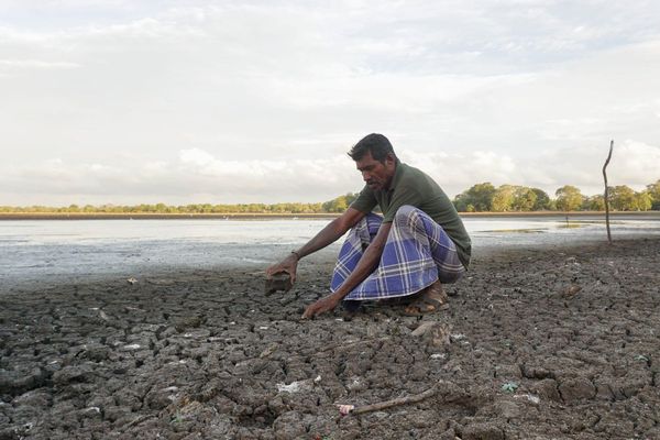
JAFFNA, Sri Lanka — Shortly before midnight on Tuesday, one of the most widely followed voices on weather in northern Sri Lanka posted an alert in Tamil that spread quickly across the peninsula.
Prof. N. Piratheeparajah, a professor of geography at the University of Jaffna and dean of its Faculty of Arts, wrote that a closely watched Indian Ocean climate index had fallen unexpectedly, that a powerful El Niño was responsible, and that the rains the North depends on in October and November could now fall well below expectations.
“This is completely contrary to the earlier forecasts,” he wrote. He asked residents to stop wasting water and to treat the groundwater and surface water now in hand as the only supply they could count on.
His assessments normally travel faster in the North than any government bulletin, and they are trusted accordingly. On the central question of whether October and November will be dry, however, his reading differs from both the outlook of Sri Lanka’s Department of Meteorology and the published research on how El Niño affects this island.
The index
The Indian Ocean Dipole measures the difference in sea surface temperature anomalies between two boxes in the tropical Indian Ocean: a western box off East Africa, running 50°E to 70°E and 10°S to 10°N, and an eastern box off Sumatra and Java, running 90°E to 110°E and 10°S to the equator. The measure is called the Dipole Mode Index. A warm west and a cool east give a positive value, which pushes convection westward and draws moisture toward South Asia. The reverse gives a negative value.
Professor Piratheeparajah reported the index falling from +0.64 to +0.18. Those figures are close to the published record, though the fall was less abrupt than he described. The Australian Bureau of Meteorology, whose weekly values most forecasters in the region watch, recorded +0.63 °C for the week ending 2 August and +0.41 °C for the week ending 9 August, so a reading near +0.18 in the following week would represent a decline spread over at least a fortnight.
The thresholds matter more than the drop. Australian climatologists treat sustained values above +0.4 °C as typical of a positive dipole and values below −0.4 °C as typical of a negative one, and by that standard the index has been in or near neutral territory all month. On 9 August the Bureau still described the dipole as neutral, noting that the index had merely reached +0.4 °C for a third consecutive week and that sustained values above the threshold are required before an event is considered established. Its models continue to expect a positive dipole to develop during the southern hemisphere spring.
The higher figure the professor cited, in other words, was never an established event that has since been lost. Weekly values move by several tenths of a degree as a matter of routine, which is why forecasting agencies wait for a run of readings.
The mechanism
Professor Piratheeparajah attributed the fall to El Niño, arguing that an El Niño of sufficient strength can suppress or shrink the dipole.
That El Niño is underway is not in dispute. NOAA’s Climate Prediction Center has an El Niño Advisory in effect and says the event is strengthening, with better than a 90 percent chance of a very strong event through the northern hemisphere autumn and winter of 2026-27. The Oceanic Niño Index for May to July stood at about +1.4 °C. El Niño is a Pacific phenomenon, however, and does not operate in the Indian Ocean. It reaches this region indirectly, through changes to the Walker circulation and the winds those changes produce.
The published literature runs the other way on the direction of that effect. During El Niño, convection over the Maritime Continent weakens, which induces easterly wind anomalies along the equatorial Indian Ocean and southeasterly anomalies along the Sumatra-Java coast. Those winds drive upwelling that cools the eastern pole while warm water accumulates in the west, producing a positive dipole. Annamalai and colleagues set out the mechanism in 2003 and Shinoda and colleagues in 2004; Cai and colleagues showed in 2011 that positive dipole events often occur alongside El Niño, while negative ones tend to accompany La Niña. Forecast models for this season have been projecting that same pairing.
One recent finding gives the professor’s observation partial cover. Research published last year in Communications Earth and Environment found that dipole events developing alongside El Niño often stall, producing a double peak rather than a steady build, because the northward migration of the Intertropical Convergence Zone allows El Niño-driven circulation to cause upwelling in the western Indian Ocean. The paper places that interruption in May and June, however, and describes a pause in development rather than a lasting suppression.
The record
The professor’s second claim is that a weak or negative dipole combined with a strong El Niño would leave October and November “very, very low” in rainfall.
A positive dipole does tend to enhance rainfall over Sri Lanka from October to December, and the Department of Meteorology has said as much in its seasonal guidance, so a dipole that fails to develop removes a source of extra rain. The El Niño half of the claim is harder to sustain. The relationship between El Niño and rainfall here is seasonal, and in the months at issue it runs positive. Lareef Zubair and Chester Ropelewski showed in 2006 that while the link between El Niño and India’s southwest monsoon has weakened over the decades, the link with the northeast monsoon over Sri Lanka and southern India from October to December has not. Zubair and colleagues later found that El Niño typically brings wetter conditions from October to December and drier conditions from January to March and July to August, with the October-to-December signal among the more predictable. A 2019 paper in the Journal of Climate traced the route: reduced convection over the Maritime Continent forces anomalous anticyclonic flow over the Bay of Bengal, which strengthens northeast monsoon rainfall over Sri Lanka and southeastern peninsular India, weakly in October and strongly in November.
Sri Lanka’s forecasters read the evidence the same way. Four days before the professor’s post, the director general of meteorology, Ajith Wijemannage, told News 1st that rainfall in October and November is likely to exceed long-term seasonal averages, that those rains may run into December and early January, and that the greatest effect is expected in the Northern, Eastern and North Central Provinces as the northeast monsoon becomes active. He described a strengthened northeast monsoon as one of the main consequences of this El Niño, and put the probability that the 2026-27 event exceeds anything in the past 75 years at 69 percent.
His department is not forecasting an easy year. It expects extremes at both ends, drought and flood in sequence rather than a single settled pattern. Its October and November projection, though, is the reverse of the professor’s.
Why the warning still holds
The appeal to conserve water stands regardless.
The Department of Meteorology expects rainfall to stay below normal in the Northern, North Central and Eastern Provinces and parts of Uva over the coming weeks, with little significant rain in most regions in early September and an increase only later in the month. Demand across the North is peaking at the same time, with school holidays, high temperatures and the season of major temple festivals. Reservoirs are already falling. Whatever October brings, the weeks before it are dry ones, and the water in the ground and in the tanks is the water available.
The professor is also right about timing. He said conditions would have to be watched until the middle of September before a firm judgment could be made about October and November, and he declined to call a failed monsoon now. Mid-September is roughly when the dipole’s seasonal development becomes legible, and when the difference between a positive event and a neutral one stops being noise.
One part of his original post has been lost in the retelling. The severe water crisis he warned of was directed at areas that received little or no rain during the southwest monsoon, the dry zone that sits in the rain shadow while the island’s southwest is watered. That is the North and East. Much of the country banks its rain in the middle of the year; the North waits for the end of it.